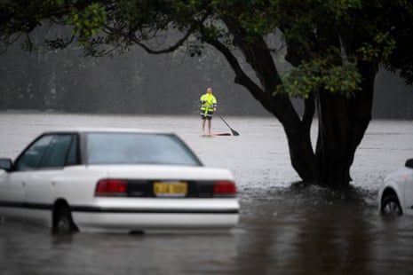
A trickle in Sydney’s rain gauge on Wednesday meant the city is yet to get a dry day in the past 16, extending the record wet start to any year for the Harbour City.
The 0.2mm reading so far on Wednesday – the smallest measure the Bureau of Meteorology counts as rain – nudged the rainfall total at Sydney’s Observatory Hill to 872.6mm.
By contrast, Melbourne’s average annual rainfall is 648mm.
24 hours until 9am parts of #Sydney saw more than 100mm of rain. This year marks the wettest start to a year on record with 872.4mm, the previous record was 815.8mm in 1956. Rain easing as low moves off the coast, surf conditions remain dangerous and river rises still possible. pic.twitter.com/NLoI2Muvot
— Bureau of Meteorology, New South Wales (@BOM_NSW) March 9, 2022
Brisbane has been even wetter, collecting 1,059.8mm so far this year. That tally, though, trails 1893 when the Queensland capital was soaked by just shy of 1.3 metres of rain by 9 March of that year.
@BOM_au says river levels at Windsor peaked around 7am Wednesday with flood levels nearly 1m above the March 2021 floods. The main flood peak in the Hawkesbury is now downstream of Wisemans Ferry.https://t.co/3xvSGIW0rO #NSWFloods pic.twitter.com/xETa755QQn
— Peter Hannam (@p_hannam) March 9, 2022
Aside from the soggiest start to any year, Sydney is also enduring 16 days of at least 8mm of rain in a row, according to Ben Domensino, a senior meteorologist at Weatherzone. The next longest stretch of such falls was 10 days, back in 1908.
“We didn’t break any one-day records but it was so persistent,” he said. Over those 16 days, the city endured 617.4mm of rain, the most for any 16-day period in records going back to 1858 – just pipping the 612.8mm recorded during a sodden spell in 1990.
The second-wettest start to the year for Sydney occurred in 1956, when 815.8mm fell in the period up to 9 March that year.
Residents in much of eastern Australia will have had to keep their umbrellas handy for a few months, not least because the La Niña event in the Pacific has increased the chances of above-average rainfall as rain systems shift westwards towards Australia.
Even though La Niña is past its peak its influence will continue for some months, pointing to a wetter-than-normal autumn, Andrew Watkins, the bureau’s head of long-range forecasting, says.
@BOM_au's outlook for March-May points to a wetter-than-usual autumn for eastern Australia, a region's mostly had a very wet start to 2022. pic.twitter.com/lJymVok2aj
— Peter Hannam (@p_hannam) March 9, 2022
La Niña “will play influence on the weather through the autumn, but we also have warmer-than-normal ocean temperatures around northern Australia at the moment, and that’ll play some role as well”, Watkins said.
The flooding, too, will itself provide a source for further rain.
“Just having so much moisture in the landscape means that over land as well as over the sea there is water that can evaporate, of course, and fall again as rain,” he said.
@BOM_au's outlook for April-June also has the odds tilting towards above-average rainfall for those sodden eastern regions. #NSWFloods #QLDFloods2022 pic.twitter.com/F077s4JDLc
— Peter Hannam (@p_hannam) March 9, 2022
For all the mayhem, the current La Niña event – the second in as many years – is only a “moderate” one.
“Sea surface temperatures got to be about 1.1–1.2 degrees cooler than normal” in the central Pacific, making it weaker than the 2010–11 and 1973–75 events, Watkins said.
Still, with soil moisture levels already high and many dams near capacity going into this past summer, it didn’t take a lot of additional rain to cause flooding. For the same reasons, a wetter-than-usual next few months could mean more floods to come.
“We don’t need big amounts of rainfall to see impacts because of how wet the landscape is,” Watkins said. “So we need to be cautious even of smaller rain events now as we don’t have to have big ones to create issues.”
