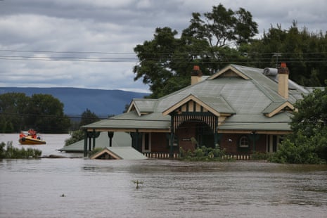
Australia’s east coast could be hit by a rare “triple La Niña” that brings flooding rains and cooler weather for the third summer in a row, a senior US government scientist says.
Experts say the prospect of a triple La Niña is real, but there is disagreement between different computer models and Australia could yet avoid a return of summer floods.
Scientists and weather forecasters are watching temperatures in an area in the tropical Pacific Ocean that has been unusually cool in recent months – one signal that the current La Niña could either remain in place until summer or fade and then return.
Dr Mike McPhaden, a senior research scientist at the US government’s National Oceanic and Atmospheric Administration (NOAA), said that “often La Niñas come in pairs – one year followed by a second”.
“But in very rare situations La Niñas persist into a third year and it looks like this might be happening this year,” McPhaden said.
“Triple dip La Niñas are rare. The last one was from 1998 until 2001 – so more than 20 years ago. This has the potential to be a triple dip La Niña that could go into early 2023.”
Seattle-based McPhaden is in Australia meeting fellow scientists and delivered a public seminar in Sydney this week on conditions in the Pacific and what they could mean for the months ahead.
Ocean surface temperatures in an area of the tropical Pacific known as Nino 3.4 – covering about 6m sq km – are used to help gauge whether there could be an El Niño or La Niña.
El Niños line up with above-average temperatures in the tropical Pacific and tend to mean hotter and drier conditions for the east of Australia. La Niñas are associated with an increased probability of rainfall and cooler temperatures and are linked to below-average temperatures in that region of the ocean.
McPhaden said in April, the Nino 3.4 region of the Pacific was at its coldest since 1950. In May, it was the coldest since 1988.
He said even though the world’s oceans were heating up because of global heating, there was enough natural variability to overwhelm that heating for short periods, or in particular regions.
The Bureau of Meterology declared a La Niña in October 2020 that lasted until March 2021. La Nina conditions then returned in November 2021 and have lasted until now.
A bureau update on the current La Niña, issued earlier this week, said it was “slowly weakening” and while most models suggested the Pacific could return to more neutral conditions, two computer models found the La Niña could remain in place all through Australia’s winter.
Dr Agus Santoso, an expert on changes to El Niño and La Niña at the University of New South Wales, said there had been about 10 back-to-back La Niñas since the 1950s, but only two periods that had seen three summers in a row with La Niña conditions – 1998 to 2000 and 1973 to 1975.
He said if the cool conditions in the Pacific remained, then a La Niña was likely at the end of this year “but I would say that’s uncertain at the moment”.
As well as being linked to floods in Australia, McPhaden said the current back-to-back La Niñas were tied to severe drought covering much of the west of the US.
This also increased the risk of wildfires and was causing water shortages for agriculture and power generation, he said. “There’s a developing water crisis in the western half of the United States – 90% is in severe or extreme drought because of this La Niña.”
While scientists are still trying to understand how the climate crisis could be affecting the scale and frequency of El Niños and La Niñas, McPhaden said global heating was still playing a role in the weather events that came from them.
“The warmer atmosphere can now hold more moisture and this could bring even more rain and amplify the impacts of La Niña,” he said.
Prof Matthew England, of the climate change research centre at the University of New South Wales, said the current La Niña conditions were lasting longer than usual.
He said at this time of year, forecast models were known to have less reliability but a third La Niña would not be welcome news for many Australians.
“I don’t think anyone wants this to happen,” he said.
“We have seen how damaging these flood events are. And it would likely be those same coastal towns up and down the coast of Queensland and New South Wales that will be hit by these events.”
Ben Domensino, a meteorologist at Weatherzone, said he thought the chances of a third La Niña summer in a row for Australia were “about 50/50” but regardless of whether a La Niña remained in place, or faded and then returned, the coming months were likely to bring cooler and wetter conditions than average.
